
September 1, 2025 started as a routine Monday. IMD had issued a Yellow Alert — the lowest tier of warning — for Delhi-NCR, advising people to carry umbrellas. Between 3pm and 7pm, Gurgaon recorded over 100mm of rainfall, confirmed by the District Disaster Management Authority. By 5pm, the city's arterial road network had effectively ceased to function.
The 2025 monsoon had already been running 30% above normal for the season, and September 2025 alone would end 59% above its monthly average. The ground was saturated, the drains were already stressed, and September 1 was the breaking point.
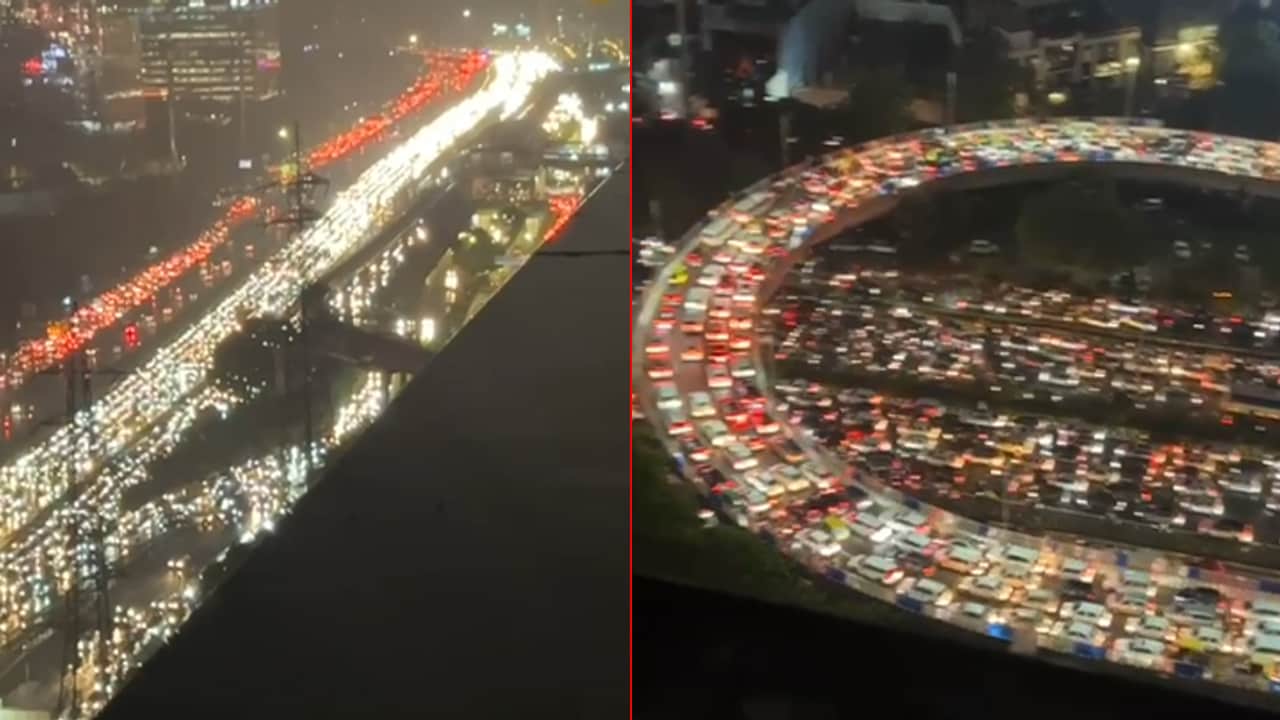
A 7km traffic snarl locked NH-48, the city's primary artery to Delhi. IFFCO Chowk, Rajiv Chowk, and the entirety of Sohna Road were submerged, with vehicles stalled in waist-deep water. Residents took to social media to decry the collapse of a city — a distance of a few kilometres taking hours, open drains submerged and invisible, exposed electrical infrastructure, and unending snarls, with zero preparation from the government and a civic infrastructure incapable of handling the monsoon.
If the road stories were alarming, the power situation was worse. Societies across Golf Course Road and Cyber City reported basement flooding that damaged electrical switchgear — the reason power outages became multi-day events rather than hours-long ones. Luxury vehicles, utterly inadequate to wade through the waterlogged roads, stood motionless across Gurugram.
Water leaked through the ceiling of the Signature Tower Chowk Underpass during the rain — an underpass designed precisely to keep roads open during adverse weather was itself flooding from above.
The September 1 collapse was not caused by exceptional rainfall alone. 133mm in four hours is intense — but manageable for a city with functional drainage. Gurugram does not have one.
The consequence is a city built on four decades of decisions, and September 1 was the predictable result.
On the evening of September 1, Deputy Commissioner Ajay Kumar ordered all private offices to enable work-from-home for September 2, and schools were directed to conduct online classes — an advisory that came hours after residents were already stranded. Police Commissioner Vikas Arora and the Deputy Commissioner conducted late-night inspections of NH-48 and Sohna Road. In the days that followed, MCG and GMDA deployed pumps, cleaned drains, and patched damaged roads, while DDMA advisories went out across channels.
Urban planners quoted in post-event coverage were blunt about what this amounted to: reactive measures, not preventive ones.
By April 2026, ahead of the current monsoon season, the Haryana government announced a "zero flood" preparedness plan. MCG identified 159 waterlogging hotspots across the city and was tasked with desilting its 607km drainage network by a May 31 deadline, with Urban Local Bodies Minister Vipul Goel directing civic agencies to adopt zero tolerance to flooding.
As of late June 2026, MCG has completed desilting work at just 16 of 36 hotspots in Zone-1 and Zone-2. The master drainage project remains stalled. The pattern residents will recognise: a severe flood, followed by high-level meetings, followed by press releases, followed by partial desilting work, followed by the same junctions flooding when heavy rain arrives.
The structural causes — the Badshahpur constriction, the drainage gap in Sectors 68-115, the lost water bodies, the stalled master project — remain in place heading into monsoon 2026.
September 1, 2025 was not a natural disaster. It was the annual invoice for a decade of deferred decisions, arriving in four hours, paid by every resident stuck on NH-48 that evening.
FloodWatch tracks Monsoon Readiness Scores across 721+ localities in Gurugram using terrain data, drainage network coverage, and proximity to known hotspots. Check your area's score and see which sectors remain most vulnerable heading into monsoon 2026.